Marmot Pass, Olympic National Park
11.5 miles round trip / 3489′ elevation gain
It’s hard to believe, but the weather forecasted for another sunny and warm winter weekend in the Pacific Northwest. As usual, this meant it was time to plan another day hike. As I mentioned in my last few day hiking posts, my husband and I have been joined by a new hiking partner. Since I have been holding our new partner back with short hikes with low elevation gains, I decided it was time to challenge myself. Letting our new friend choose the hike this week, we began our day on the Edmonds ferry headed west towards Marmot Pass in the Olympic Mountains. I always love starting my day hikes with a 360° view of the Puget Sound surrounded by mountains. As we made our way along the Olympic Peninsula across the Hood Canal bridge, I spotted a glimpse of two dolphins jumping out of the water in unison. As we passed the turn off to the Lower Big Quilcene Trail, which my husband and I had just hiked a few weeks before, I was feeling nervous about pushing my abilities. I was on my way to my longest day hike with the highest elevation gain I had ever attempted with nearly three miles of snow hiking!
We arrived at the trail head and started our journey along the Upper Big Quilcene Trail #833.1 just after 10:00 am. The trail begins by slowly ascending as it follows the meandering Big Quilcene River. The shade provided by the old growth forest canopy kept a cold chill in the air for the first two and a half miles. The close to freezing temperatures kept a slight frost on the forest floor and parts of the trail as icicles hung from logs along creek crossings. We welcomed the colder temperatures as the trail began to ascend at a steeper grade keeping our bodies quite warm. After a few miles, the trail breaks away from the river and begins climbing across scree fields. As we started to hike upon our first scree field we heard a loud cracking sound followed by yelling in the distance and noticed a small group of hikers stopped ahead of us. The group was looking up towards the ridge line, and at that moment a very large rock bounced off the trail what seemed like only a few steps away from one of the hikers. Moments later a much larger rock, that very easily could have been disastrous, came flying by the trail in the same section. After a few nerve racking minutes we quickly raced our way across the scree field to catch up to the other group of hikers. With fear in their eyes, we discussed with the group where the large rocks came from and what caused them to move from their once quiet resting place. No matter the cause, we all decided it was best to move along the scree field as quickly as possible to seek comfort among the trees. Once we reached the safety of the surrounding trees, we rested and tried to relax before heading back up towards the pass.

Crossing a scree field along the trail to Marmot Pass, Olympic National Park

View from the trail to Marmot Pass, Olympic National Park
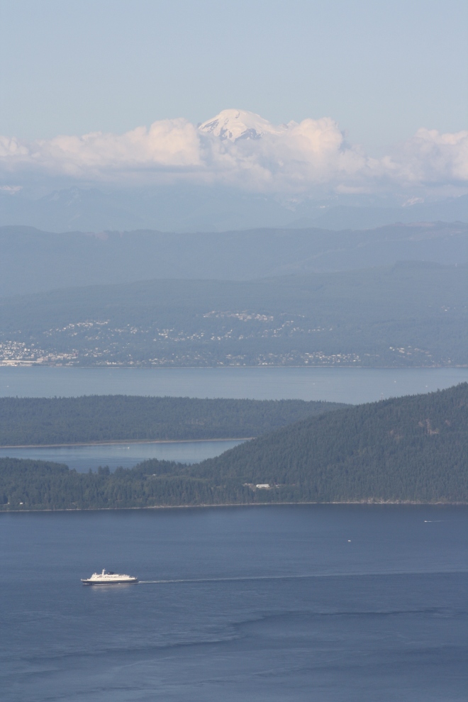
The feeling of comfort didn’t last long since shortly after leaving the scree field behind us, the trail began to ascend into areas with small patches of snow. As I have mentioned before, being a Southerner most of my life I am not too comfortable hiking in snow and ice. Although the feeling of anxiety was beginning to rise, I was more prepared for the icy conditions having packed my newly purchased ice trekker chains. I chained up and we continued our way up the trail which eventually became completely snow covered. I was feeling fairly confident with the safety of my chains for the first section of the snow, but the trail soon became very steep. The combination of snow, ice, and steep conditions threw me out of my comfort zone and anxiety took over. At that moment I decided that an 8+ mile hike was respectable, and I could turn around feeling proud of what I had accomplished thus far. I made my way back down the trail until I felt comfortable enough to stop and rest. As I rested I watched my husband and friend make their way along the snowy switchback which looked very similar to the one I had just climbed. After a short conversation with hikers making their way down from the mountain pass above, I gained the confidence I needed to push forward and try again. I made my way along the steepest section of the snow covered trail with an inner dialog telling myself to take one step at a time and not to look down. Realizing it wasn’t as scary as it seemed in my head, I gained more and more confidence and continued quickly up the trail with Marmot Pass now in sight just past a large snow filled meadow. At this point I was lightly jogging upwards and finally made the last push to my final destination. I had made it! I welcomed the breathtaking views that surrounded me including Mount Baker and the Cascade mountains to the east with the Puget Sound waterways below. The Olympic mountains extended from Marmot Pass with long, craggy peaks to the north, west, and south.

Marmot Pass, Olympic National Park

The view from Marmot Pass looking east, Olympic National Park

The view from Marmot Pass looking west, Olympic National Park

Looking up at Buckhorn Mountain from marmot Pass, Olympic National Park
Even though I made my way quickly up the trail in hopes to catch my husband and friend at the pass, they had already started to make their way south to explore the ridge line. I enjoyed watching the two of them as they made they way along the snow covered ridge backlit by the midday sun. I kept a close eye on them concerned they would choose another way down the trail without our paths crossing.

My husband and friend along the ridgeline south of Marmot Pass, Olympic National Park
Finally feeling relaxed, the sun filled mountain pass was the perfect afternoon lunch spot amongst several other hikers. Even though we had climbed over 3500 feet, the air was warm from the direct sunlight. Conversation with like minded people was pleasant and comforting after the long trek up. I noticed my hiking partners closing in on my location at the pass, but they paused as they got closer. Just as I had suspected, I could see them considering following the tracks of previous hikers who had chosen to glissade down instead of following the traditional trail. It was at this point I decided to flag them down to make them aware of my location. Once they realized I was the one waving and yelling in their direction, I packed up and made my way back down the trail. The three of us were back together again just below the pass in the snow field after my partners had attempted to glissade down. They were excited to see I had made it to the pass after all, and I was glad to be with my group once again.
We all shared a sugary snack and swapped stories about the last hour we’d spent apart before making our way back down the trail. Feeling more comfortable than ever, the fears I’d faced before seemed to be a distant memory. We zig-zagged along the snowy path sharing good conversation about our future hiking plans. Before I knew it, the snow turned into patches and then finally disappeared altogether. We moved quickly as the trail descended towards the parking lot. Once again we swiftly moved across the scree fields back into the thick forested path. Making great time, we crossed over creeks that were slightly higher from the days snow melted by the warm winter sun. We knew once we had reconnected with the Big Quilcene River we were closing in on our last miles of the hike. We climbed over two logs that blocked the path one last time as we made our final descent to the trails’ end. Our aching muscles welcomed the sight of the parked cars along the forest road. The sun was making its way behind the Olympic Mountain peaks as we drove along the Peninsula once more. The sky filled with pink and purple clouds as the sun made its final appearance for the day. It was the perfect ending to a perfect day in the mountains.

