
Prickly pear cactus flower, Coconino National Forest, AZ

Prickly pear cactus flower, Coconino National Forest, AZ

Cactus flower, Cottonwood Trail near Mile 344 of the Arizona Trail, Tonto National Forest, AZ
After my first three days attempting to thru-hike the Arizona Trail, I decided to get off the trail and re-group. I spent two days exploring the campground at Patagonia Lake State Park with my aunt. During this time, I washed my clothes in a bucket, went through my pack and tossed out any unnecessary items, and continued to communicate with my hiking partner in hopes that we would get back on the trail soon. During one afternoon, my aunt and I went to the marina to see about renting kayaks to tour around the lake. A very nice gentleman running the marina offered to take us on a quick pontoon boat ride to tour the lake since the wind was too fierce for a kayak trip.

My aunt and I touring Patagonia Lake, Patagonia Lake State Park, Patagonia, AZ

Patagonia Lake State Park, Patagonia, AZ

Patagonia Lake State Park, Patagonia, AZ

Patagonia Lake State Park, Patagonia, AZ

Primitive campsite on the shoreline of Patagonia Lake, Patagonia Lake State Park, Patagonia, AZ
The lake and State Park were beautiful with lots of little primitive campsites tucked away which are only accessible by boat. The two days I spent at Patagonia Lake with my aunt after the first three days hiking the AZT were perfect. I believe that things happen for a reason, and even though I was feeling pretty low having to get off the trail so soon, the time spent at the lake was very special.

Snake crossing the trail, Red Rock State Park, AZ
I would like to preface this blog post by stating that I am no longer thru-hiking the Arizona Trail. After hiking only 34.6 miles, I made the very tough decision to get off the trail and end my thru-hike. Before leaving Arizona, I decided to spend time exploring the state with friends and family. I plan to share my adventures along the AZT and journeys throughout the state over the next few weeks in segments. Here is the story of my first three days on the Arizona Trail:
3 days, 2 nights / 22.5 miles / 3000′+ elevation gain/loss

Looking back towards the Mexico border from the Arizona Trail near Montezuma Pass
Day one: Montezuma Pass to Mexico border to Bathtub Spring
10 miles / 3000’+ elevation gain
Nervous is the one word I would use to describe the morning of my first thru-hike attempt. All of the planning and organizing had led up to this moment, and now that it was here, I was petrified! Scared as hell, yes, but also ready for an adventure.
I woke up before sunrise on the morning of my first day on the Arizona Trail. I was nervous, but excited knowing I would have my aunt joining me as I hiked the first 50 miles over the next five days. In many ways she has inspired me to find a love in backpacking, and I was happy to finally share that passion with her. She and I set out early that morning to catch a shuttle to Montezuma Pass with 3 other hikers I had met online several weeks before starting the trail. As a group we made plans to try and hike at least the first 120 miles together. It comforted me knowing that I had connections along the trail, and I was thrilled to be creating new friendships.

Our group ready to start our first day on the Arizona Trail.
After a drive up a long and winding gravel road, we arrived at the Montezuma Pass parking lot in the late morning. Mile 0 of the Arizona trail starts 1.7 miles from the parking lot and retraces its’ steps back. Since my aunt did not intend to thru-hike the entire AZT, she kindly opted to stay in the parking area with our backpacks while we hiked the first 3.4 miles to the Mexican border and back. This was it – we were finally starting this incredible journey!

Signing the National Registry for the Arizona Trail

Sign near the Mexican border on the Arizona Trail

The monument at the Mexican border for the beginning of the Arizona Trail

Our group at the Mexican border at the beginning of the Arizona Trail
The morning was nice with mild temperatures, blue skies and pure sunshine. The first 1.7 miles of the trail descent down towards the Mexican border, making it a fairly easy hike. The next 1.7 miles back up towards the parking lot weren’t as easy since we were finally starting our ascent up the Huachuca Mountains. By the time we reached the parking lot we were parched and happy to take shelter in the shade for lunch.

Hiking back up towards Montezuma Pass from the Mexican border, Arizona Trail

Spring flowers, Arizona Trail

Cactus, Arizona Trail

Looking south towards the Mexico border, Arizona Trail near Montezuma Pass
During our lunch break at Montezuma Pass we had the opportunity to meet the founder of Warrior Expeditions along with three of his warriors kicking of their hike on the Arizona Trail. I was so excited to be starting my hike surrounded by so many people. I was energized and ready to throw on my pack and really start this adventure. My aunt took our first ten steps together side by side grinning from ear to ear.

My aunt and I about to take our first steps on the Arizona Trail
We set out on the Arizona Trail with a goal of making it to Bathtub Spring that evening hiking 6.6 more miles. Right away the climb up was tough – temperatures were warming and the trail was completely exposed. All morning my body wasn’t feeling 100%, but I assumed it was just nerves. As the day progressed I continued to feel uneasy, but was able to slowly hike on. The next four miles of the trail gain over 3000′ of elevation as it makes its’ way up towards the spine of the Huachuca Mountains.
Looking south towards Montezuma Pass, Arizona Trail

Arizona Trail near Montezuma Pass

Arizona Trail
At some point my aunt and I stopped to rest in a rare shady spot, and one of our hiking partners arrived shortly thereafter. He notified us that our other hiking partner was feeling ill after hiking a few miles. She and her daughter decided to take shelter in their tent until feeling well enough to continue hiking on. We suspected altitude sickness considering we started our hike at 6000′ and would be ending the day at just over 9000′. We stayed connected using our gps devices communicating about potential camping spots along the way up. Unfortunately, it wasn’t long before we all realized that the best decision for our ill hiking partner was to leave the trail as her symptoms continued to worsen. By the time the three of us reached the highest point of our hike, we were exhausted and still had more miles to go.

Just after reaching our high point for the day on the Huachuca Mountains, Coronado National Forest
As we hiked along the ridgeline of the Huachuca Mountains, the sun was beginning to set which created an urgency to move quicker. The terrain changed with every turn of a corner, and before we knew it the sun had set and all of that beauty had whizzed by. Thankfully, we stumbled into the area near Bathtub Spring with moments of light to spare. We were even more grateful that the warriors were camping in the area and happy to share the very tight quarters with our group. I have never seen six tents in a smaller area!
With headlamps running, the three of us set up our tents in the dark of night. Shortly thereafter I puked behind a tree nearby. My body had finally lost the battle with altitude sickness and I was feeling awful. It took everything I had to drink water, send out sad messages to my husband on my Garmin about how awful the night was, and try not to fall asleep with dried bananas in my mouth that I was forcing myself to eat. It was a very crazy first day on the Arizona Trail.
But it wasn’t until the middle of the first night on the trail that things really started to get crazy. It was very cold with temperatures less than 30°, and as the night progressed a fierce wind storm blew in. All I could hear is what appeared to be the cracking sounds of trees swaying in the wind around me. I continued to imagine myself being crushed by a giant tree inside my tiny tent. As time passed into the early morning hours, the wind storm brought rain, that turned to hail, and eventually turned to snow.
Day two: Bathtub Spring to Parker Canyon Lake trailhead
12.5 miles / 3000’+ elevation loss
I woke up on the second day in southern Arizona surrounded by a light dusting of snow. I crawled out of my tent still feeling sick to my stomach with shortness of breath. I forced myself to eat a hot breakfast and hurriedly packed up for the days’ long hike ahead. Our goal was to make it to the Parker Canyon Lake trailhead where we would be dry camping for the night.
The morning was beautiful as we hiked along the ridgeline of the Huachuca Mountains heading north. As we made our way down the western side of the mountain range, the trail switched back and forth descending through diverse terrains. We started our day with a chill in the air walking through patches of snow, and ended the day in the warm desert.

My friend hiking through patches of snow near Bathtub Spring, Arizona Trail

My aunt hiking down the western side of the Huachuca Mountains, Arizona Trail

A view of Parker Canyon Lake viewed from the Huachuca Mountains, Arizona Trail
As I hiked down into a lower elevation I began to feel much better and was able to hike at a pretty good pace. The downhill trek was toe-pounding and by the time we reached the base of the mountains my feet were beginning to get pretty sore. I welcomed the flatter section as we made our way through Sunnyside Canyon. A small creek flowed, only a trickle at times, alongside the trail for nearly 3 miles. Near the end of what we believed was our last water source for the day, our group stopped and filtered water. I carried 6 liters of water for the last 4 miles of the hike, hoping it would be enough until our next water source the following day. Funny thing was, we continued to see water almost the entire way in intermittent pools along Scotia Canyon.
By the time we reached our destination after hiking more than 12 miles, we were spent. Well, my aunt and I were spent, but our other hiking partner was an experienced section hiker who was just getting started. It was at this time my aunt let me know she couldn’t hike any further. She was planning to hitch a ride from Parker Canyon Lake campground the following morning.
Arriving at our destination with little daylight to spare once again, we hurriedly setup camp and prepared a hot dinner before sunset. After a certain point in the day, I stopped looking around me, stopped taking pictures, stopped enjoying the moment. During the sunset on the second evening of my hike on the Arizona Trail I was able to stop and look around me and be in that “Kodak memory moment,” as my aunt would say.
That evening was emotional for me and I had a lot to think about. Even though I knew my plans would be shifted as soon as I started the trail, I was panicking as it felt like everything was falling apart around me. What started out as a group of 5 was now down to a group of 2. My only hiking partner was a skilled section hiker with plans to hike 15+ miles each day; a pace I could never keep up with. My options at this point were to either continue hiking the trail alone or leave the trail with my aunt and regroup.
On day 3 of my thru-hike attempt on the AZT I decided to get off the trail. I hoped to reconnect with my original hiking partner and her daughter and get back on the trail soon. It was a bittersweet moment that morning as we said farewell to our new friend who was continuing his journey along the Arizona Trail alone. I was so proud of those people that could hike on, but so disappointed in myself for not being able to.

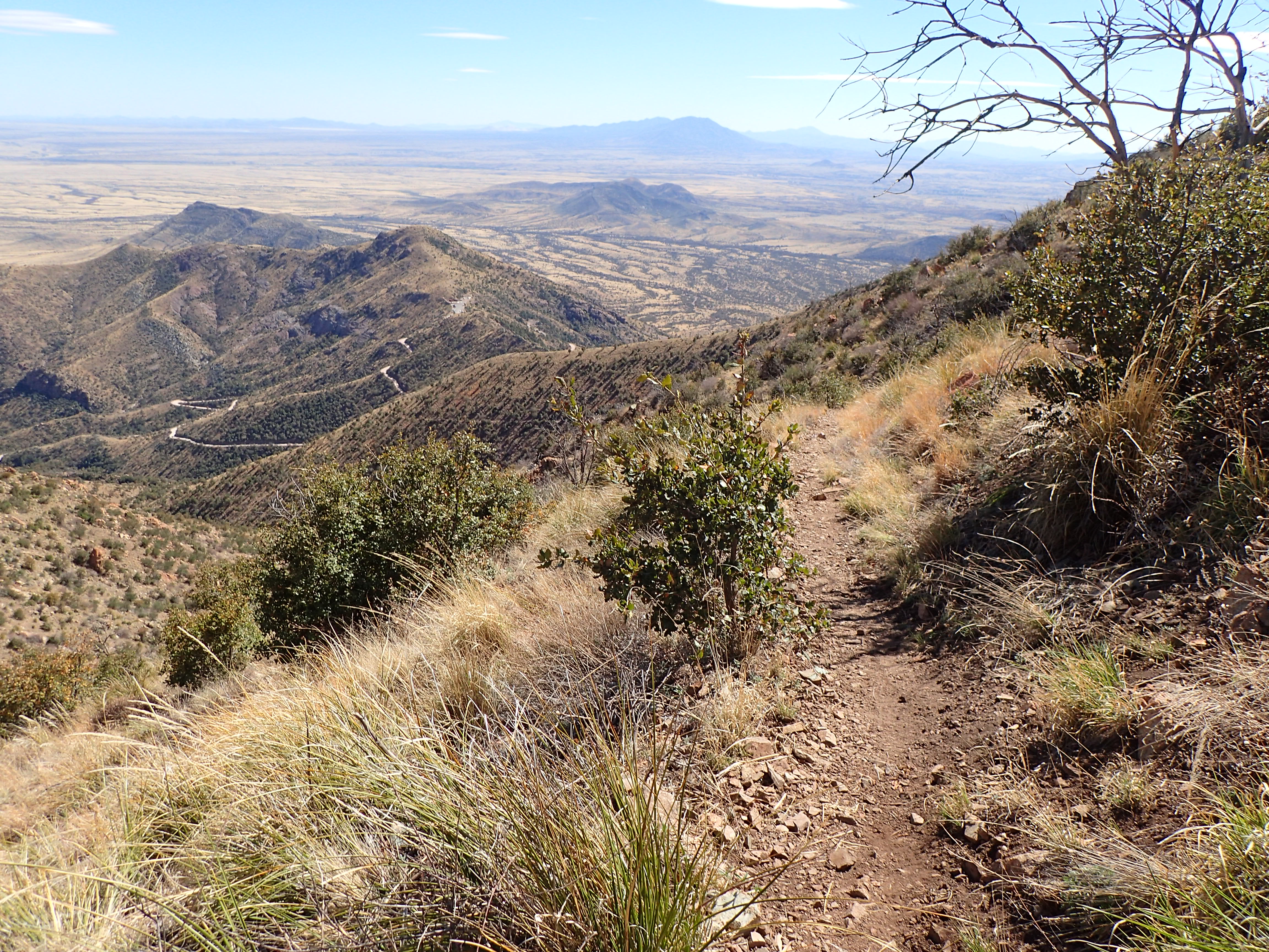
Looking back towards the Huachuca Mountains from the Parker Canyon Lake Trailhead, Arizona Trail

Parker Canyon Lake view from the Arizona Trail
Through the kindness of others and connections we had already made on the trail in only 3 days, my aunt and I found our way back to Patagonia Lake State Park. It was here where I spent the next two days reconnecting with my original hiking partner and coming up with a new game plan to get back onto the Arizona Trail. This adventure was not over yet.

Sunset view from Catalina State Park, AZ

Santa Catalina Mountains, Catalina State Park, AZ

Alpenglow on the Santa Catalina Mountains, Catalina State Park, AZ

Alpenglow on the Santa Catalina Mountains, Catalina State Park, AZ

Alpenglow on the Santa Catalina Mountains, Catalina State Park, AZ

Desert tree sunset, Catalina State Park, AZ
I finally arrived in Arizona earlier this week and have been packing like crazy for my thru-hike on the Arizona Trail. I arrived at my aunts’ house to a pile of various packages (most of them from Amazon.)

Packages piled up for AZT re-supply boxes.
It took a few days, but I have turned the pile into 10 neatly organized and packed re-supply boxes ready to be shipped and delivered throughout the state.

AZT re-supply boxes almost completed.
I had the pleasure of hand delivering one box to an old friend yesterday while visiting Jerome, AZ. It was a nice break from all the madness that comes from prepping for a long distance hike. I spent the afternoon having good conversation, and even managed to squeeze in a short hike. This afternoon I will be shipping my first two boxes – one to Colossal Cave Mountain Park, and one to The General Kearny Inn. This is all starting to get very real!

The first two re-supply boxes to go in the mail.
This is my first of many blog posts from my iPhone 6s. With limited resources during my adventure, and I’m sure as hell not carrying a laptop with me, I’ll be using my phone to blog along the way. Next Monday, March 27 is go time! I can’t wait for the journey that lies ahead. Happy trails!
The most frequented questions I receive once I start discussing my thru-hike on the Arizona Trail are about food. Does that mean you will be carrying all of your food on your back? Yes. Isn’t that really heavy? Yes. Are you crazy? YES! How will you get more food while hiking along the trail? Re-supply boxes.
I’m pretty sure it’s impossible to carry 2 1/2 months worth of food on my back. Even if it was possible, why bother when you can re-supply along the way. While I won’t be carrying 70 days worth of food with me, I do plan to carry up to 8 days worth of food at times. During my 800 mile hike, I will be shipping myself packages along the way that will include many important items; but most importantly – my food. My boxes will also include things such as first aid supplies, toiletries, stove fuel, batteries, and Ziploc bags.
Luckily for me, there are many hiker friendly locations along the trail that will accept and hold packages for Arizona Trail thru-hikers. Here is my re-supply plan and the locations that I will be shipping boxes to:
Mile 52.8: Patagonia, 3/30 – I will have a re-supply box in my aunt’s car, who will be hiking the first 5 days with me.
Mile 119.6: Colossal Cave, 4/5 – Colossal Cave Mountain Park, 16721 E. Old Spanish Trail, Vail, AZ 85641
Mile 206.6: Oracle, 4/14 – Chalet Village Motel, 1245 W American Avenue, Oracle, AZ 85623
Mile 264.9: Kearny, 4/20 – General Kearny Inn, 301 Alden Road, Kearny, AZ 85137
Mile 345.9: Roosevelt Lake, 4/27 – Roosevelt Lake Marina, 28085 N AZ HWY 188, Roosevelt Lake, AZ 85545
Mile 440.1: Payson, 5/6 – LF Ranch, P. O. Box 796, Payson, AZ 85547
Mile 464: Pine – THAT Brewery, 3270 N HWY 87, Pine, AZ 85544
Mile 537: Mormon Lake, 5/16 – Mormon Lake Lodge, 1971 South Mormon Lake Road, Mormon Lake, AZ 86038
Mile 569.3: Flagstaff, 5/19 – A friend will be picking me up to spend a night or two off trail.
Mile 690.6: Grand Canyon South Rim, 5/29 – Grand Canyon Post Office, General delivery, Grand Canyon, AZ 86023
If you are interested in sending a small package to me during my journey, make sure the package contains my name and an anticipated arrival date.

AZT Re-supply location, Colossal Cave Mountain Park
If you are hiking the Arizona Trail this year or have hiked it in recent years, I’d love to hear your thoughts on my re-supply plan. This is my first thru-hike, and I’ll take any advice you’re willing to share. Happy trails!
I will be flying to Phoenix to start my journey along the Arizona Trail in just a few weeks. Before I make my way to Arizona, I will be taking a detour to Texas to visit my friends and family. What this means is, I only have 12 days before I walk out of my house packed and ready for my hike along the AZT. While food is one of the most important things to plan while preparing for a thru-hike, I have made zero plans! Well, that’s not completely true…I have spent the last couple of weeks dehydrating 14 kiwi, 8 pineapples, and 2 bananas. While this may sound like a lot of fruit, this barely scratches the surface of meal prep for an 800 mile thru-hike. Since I don’t have enough time to make all of my meals for this journey I’m about to take, my only plan so far is to dehydrate as much fruit as I can until the day I leave. What are some of your favorite fruits to dehydrate for backpacking or thru-hiking?

Dehydrating bananas for the AZT

Dehydrating kiwi for the AZT

Dehydrating pineapples for the AZT

14 kiwi, 8 pineapples, and 2 bananas
6.5 miles / 350′ elevation gain
Yesterday I spent two hours of my afternoon “hiking” along the Elliott Bay Trail carrying a 22.5 lb. pack. Over the weekend I purchased new trail runners to wear during my hike along the Arizona Trail, so I decided it was time to test them out. The first day of my thru-hike on the AZT I plan to hike 13.5 miles gaining over 3000′ in elevation. After finishing this short hike, it looks like I have a lot of training ahead of me over the next few weeks.

“Hiking” through the SAM Olympic Sculpture Park, Seattle, WA

A view of Mount Rainier along the Elliott Bay Trail, Seattle, WA
