
Rainbow Falls, Wailuku River State Park, Big Island, Hawaii

Rainbow Falls, Wailuku River State Park, Big Island, Hawaii

O’ahu, Hawaii

Boulder River Falls, Mount Baker – Snoqualmie National Forest, WA
7.7 miles round trip / 1167′ elevation gain
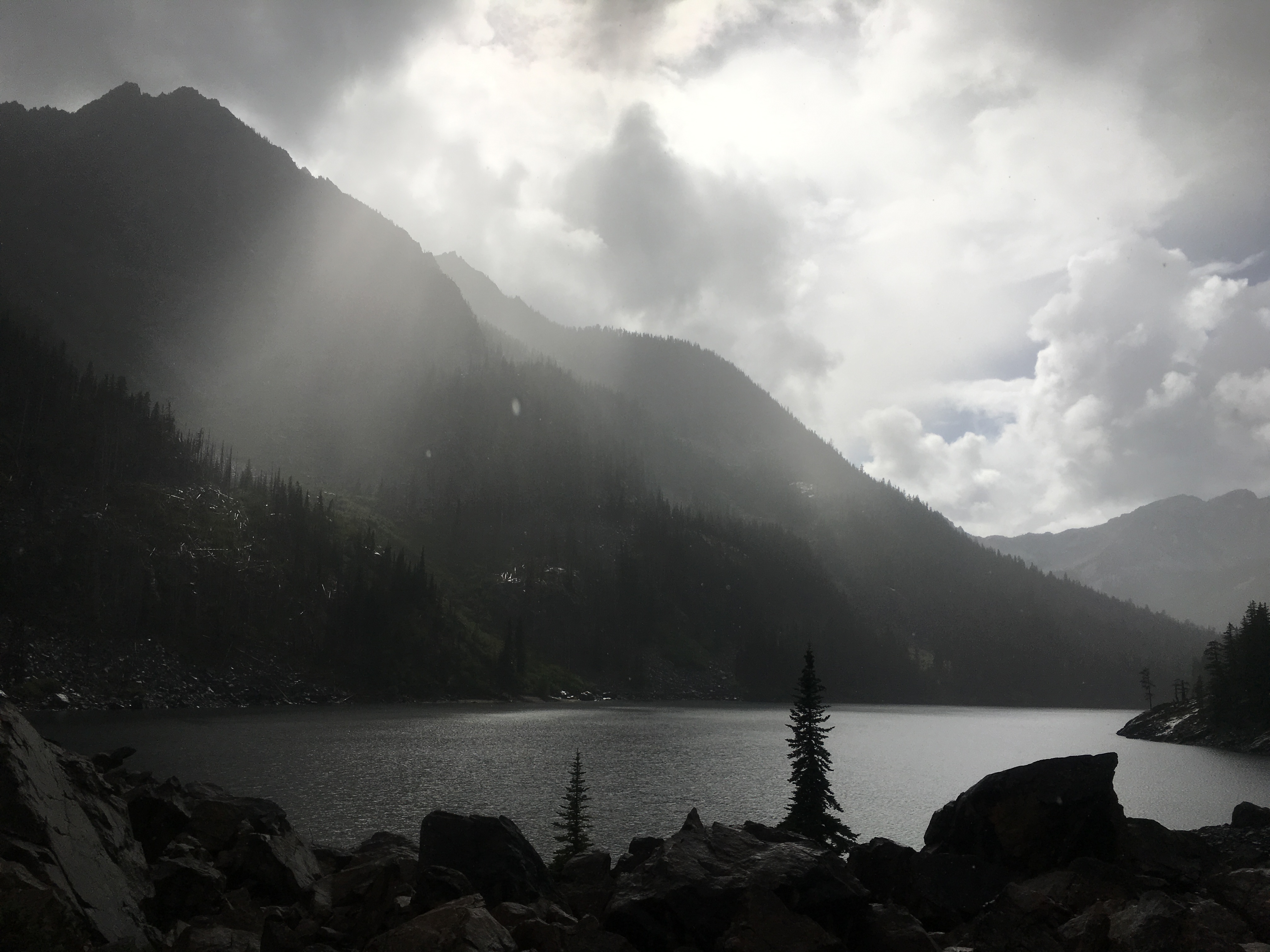
The rainy season has finally arrived in the Pacific Northwest, but that hasn’t stop me from hitting the trails. A friend from the Pacific Northwest Outdoor Women Group asked if I’d like to join her on another mid-week hike, and I was thankful for the invitation. I headed towards the Iron Goat Trail anticipating a rainy trek even though the sun was trying to make its’ way into Seattle as I left. As I made my way towards Stevens Pass the weather turned to cloudy and rainy. My friend and I met in a completely empty parking lot with a slight break in the weather including hints of sunshine peaking through the clouds. The two of us weren’t fooled by the temptation of the sun and hit the trails wearing a final layer of wet weather gear.
After taking a class at REI last week learning to identify chanterelle mushrooms in the wild, I was excited to test my knowledge in the field. The conditions were perfect for mushroom hunting in Washington, and they were everywhere! Unfortunately, I didn’t find any chanterelles, but I did had a fun time trying.
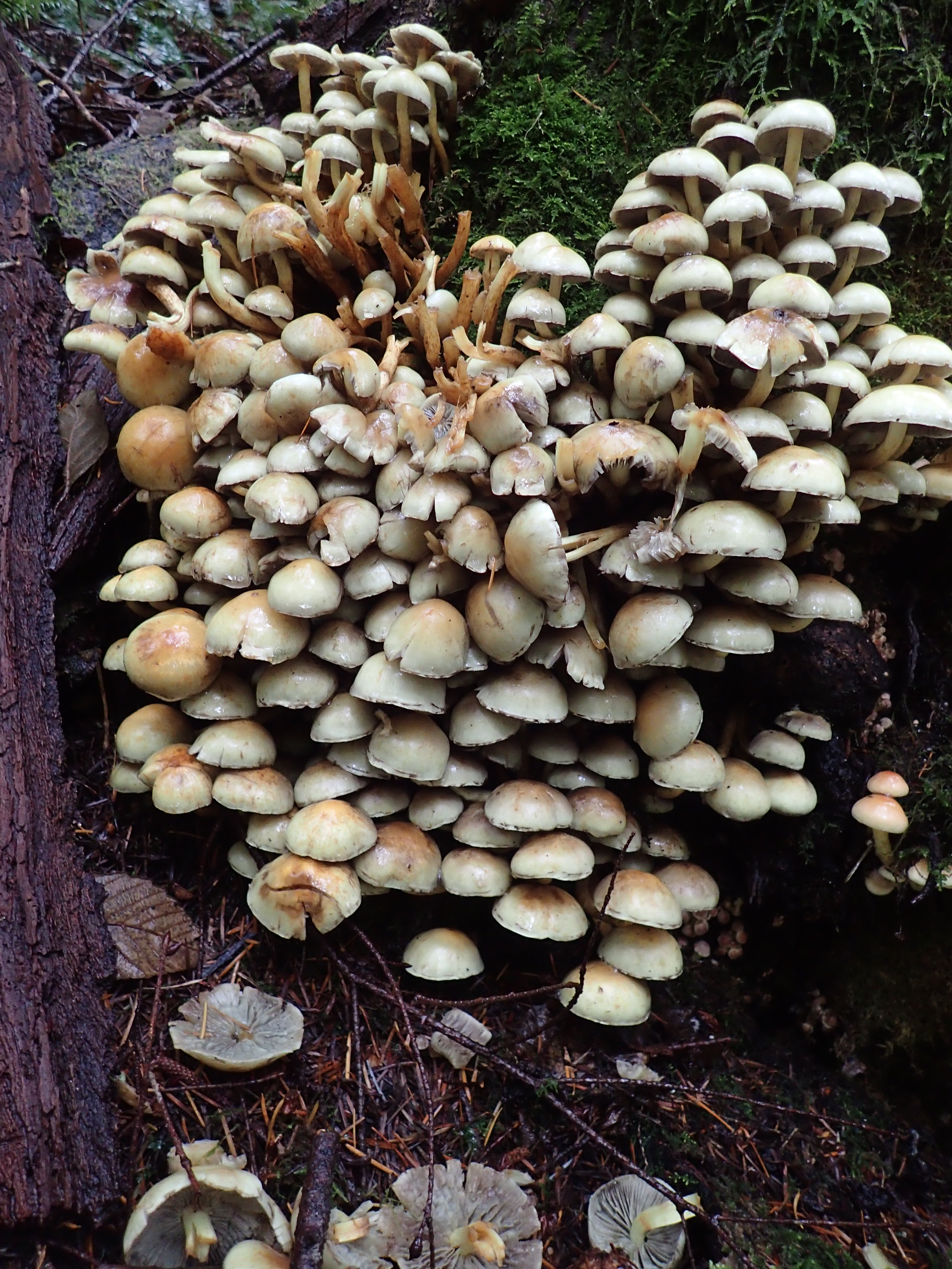
Mushrooms, Iron Goat Trail, Mount Baker – Snoqualmie National Forest, WA

Mushrooms, Iron Goat Trail, Mount Baker – Snoqualmie National Forest, WA

Mushrooms, Iron Goat Trail, Mount Baker -Snoqualmie National Forest, WA

Mushroom, Iron Goat Trail, Mount Baker – Snoqualmie National Forest, WA

Mushrooms, Mount Baker – Snoqualmie National Forest, WA

Mushrooms, Iron goat Trail Mount Baker – Snoqualmie National Forest
We started our hike at the Martin Creek trail head making our way east along the lower grade. The pathway is wide, winding is way through the mossy forest. At times the warm colors of fall leaves blanketed the landscape.

Iron Goat Trail, Mount Baker – Snoqualmie National Forest, WA

Iron Goat Trail, Mount Baker – Snoqualmie National Forest, WA

Iron Goat Trail, Mount Baker – Snoqualmie National Forest, WA
After about 3 miles of hiking we arrived at another trail head and parking lot with a bright red restored railway car. We took a quick break and enjoyed reading about the history of the area on the posted interpretative signs and maps.

Restored railway car, Iron Goat Trail, Mount Baker – Snoqualmie National Forest, WA
From this parking lot we took the Upper Loop Trail towards Windy Point. This section of the trail is much more primitive than the lower grade. It steeply climbs upwards, switching back and forth through the tress with their roots jutting out in every direction. By this time the rain had become steady, making the trail very muddy. After about a mile, the trail meets the upper grade where we chose to take the 1/4 mile journey making a right towards Windy Point viewpoint.

View from Windy Point, Iron Goat Trail, Mount Baker – Snoqualmie National Forest, WA

Snow bridge, Iron Goat Trail, Mount Baker – Snoqualmie National Forest, WA
We took shelter from the rain inside a tunnel where we enjoyed lunch in a dry space. Several tunnels can be seen along the trail with signs warning hikers not to travel too far inside. The two of us made sure to pay attention to the signs only hiking in allowed areas.

Tunnel, Iron Goat Trail, Mount Baker – Snoqualmie National Forest, WA

Tunnel, Iron Goat Trail, Mount Baker – Snoqualmie National Forest, WA

Tunnel, Iron Goat Trail, Mount Baker – Snoqualmie National Forest, WA

Tunnel, Iron Goat Trail, Mount Baker – Snoqualmie National Forest, WA
We decided we didn’t have the time to hike the additional 3 miles and back to visit the Wellington Avalanche Disaster site. The two of us hiked back towards the trail head, this time taking the upper grade section of the trail. This portion of the path follows the remains of the railroad more closely, where at times the snow bridges become the trail itself.

Snow bridge, Iron Goat Trail, Mount Baker – Snoqualmie National Forest, WA
The steady rain continued during last few miles of our hike creating large puddles in the middle of the pathway. I felt like a kid splashing my way down the trail, happy that I didn’t let the weather keep me from exploring the outdoors. I enjoyed photographing nature along the way with my new waterproof camera, not letting the weather get in the way of my art as well. It was fun to compare photographic shots with my hiking partner who also enjoys nature photography as she hikes.

Flowers, Iron Goat Trail, Mount Baker – Snoqualmie National Forest, WA

Heart shaped leaf, Iron Goat Trail, Mount Baker – Snoqualmie National Forest, WA
As I reached the parking lot completely soaked from head to toe, I had learned a few lessons: 1. Get better wet weather gear! 2. Always have a clean, dry pair of clothes in the car for the drive home. 3. I will never let the rain keep me from going outside. I was so cold on my drive home that I stopped in Monroe to buy a sweater and a hot latte. By the time I reached Seattle that afternoon, the skies had opened up once more leaving the rain in the mountains behind me.
5.4 miles round trip / 1350′ elevation gain
This fall has been a great hiking season in the Pacific Northwest with incredible weather throughout September. I was excited when a friend contacted me about a mid-week hike to Lake 22 last month. She and I met through the Pacific Northwest Outdoor Women Group, which has been a great resource for meeting women who love the outdoors.
I left Seattle early in the morning and discovered how much I enjoy hiking mid-week. The highways were wide open as I headed north, with gridlocked traffic travelling in the opposite direction. In no time, I arrived to a mostly empty parking lot just as my hiking partner arrived. We layered up and hit the trail with a cool, crisp chill in the air anticipating to warm up quickly from the uphill hike.
The trail to the lake slowly climbs its’ way up into the forest switching back and forth through the trees. Once the trail crosses Twentytwo Creek, it continues alongside it with the sounds of rushing water always in the near distance. With several creek crossings along the way, many little waterfalls can often be seen and heard. At times the trail is taken over by the large tree roots jetting out from the sides. One long section of the trail crosses a large scree field and opens up to wide views of the valley below. It seemed like out of nowhere, Lake 22 appeared right in front of us dominating the landscape.

Lake 22, Mount Baker – Snoqualmie National Forest, WA

Lake 22, Mount Baker – Snoqualmie National Forest, WA
The two of us made our way along the shoreline of Lake 22 following the well maintained trails and boardwalks. After seeing a pika warning us to stay away from the the boulders below Mount Pilchuck, we found a shady spot nearby to rest and enjoy a quick snack. My hiking partner and I both enjoy nature and wildlife photography, so we had our cameras equipped and ready to shoot as we snacked and shared hiking stories by the lake shore. As we continued along down the trail, the sun was sparkling in the reflection of the lake waters.

Lake 22, Mount Baker – Snoqualmie National Forest, WA

Lake 22, Mount Baker – Snoqualmie National Forest, WA
Although we were virtually alone during the hike up to Lake 22, the trail was packed with fellow hikers as we made our way back down. With camera in hand, we stopped at each creek crossing hoping to get shots of the rushing waters we could hear in the distance. Unfortunately, many of the waterfalls are just out of reach for a good photograph, so mostly only mental pictures were taken.

A small waterfall along the Lake 22 Trail, Mount Baker – Snoqualmie National Forest, WA
We arrived to a very full parking lot in the early afternoon. I was happy to have enjoyed another beautiful day in the PNW with a new friend. With similar hiking styles and good conversation, I left hoping that this would our first of many adventures together.

African Daisy, Butchart Gardens, Victoria, BC, Canada

Fall Leaves, Dosewallips State Park, WA
After spending one day of hiking in the Enchantments, my husband and I knew we’d be back soon – little did we know it would be the following weekend! With an extended weekend on the calendar for the Labor Day holiday, we knew it was the perfect time to get out and explore the Alpine Lakes Wilderness further. We knew there would be challenges with getting a good camping spot during a holiday weekend, but created a plan to beat the crowds.
On Thursday morning I left Seattle on my own at 7:00 am with the car loaded full of camping and backpacking gear. The plan was for me to go ahead of my husband and find a great camping spot along Icicle Road. Then, he would take the train to Leavenworth the following day where I’d pick him up. As planned, I arrived early enough to claim a beautiful camping spot in Lower Johnny Creek Campground just alongside Icicle River. As I setup camp, the weather threatened rain but luckily it stayed dry throughout the morning.
That afternoon I took a trip into Leavenworth for lunch, grocery shopping, and a stop at the USFS Ranger Station for questions about hiking trails and backpacking permits. We were hoping to possibly grab one of the first-come, first-serve permits for one night in the Enchantments during our trip. After discussion with the park ranger, my husband and I decided it wasn’t worth driving back into Leavenworth so early in the morning for a very small chance of getting a permit.
As I headed back to the campground for the evening, dark clouds increasingly filled the sky. I arrived at camp just soon enough to tie a tarp up over our spot before it began to rain. After dinner, I spent the evening reading while enjoying the peaceful sound tapping of the rain on the tarp above me. As soon as it got dark, I climbed into my tent where I continued to read into the night. I enjoyed the solitude of solo camping for the second time now. The sound of the rain lulled me to sleep that night as I lay in my tent alone.
It continued to rain into the following morning. I stayed in my tent as long as I could stand it, and finally climbed out and hurried to the car. I decided to spend the day exploring Leavenworth as I waited for my husband to arrive on the train. As I began my walk around town, I was greeted by a mountain goat in a fenced area near the Enzian Falls Putting Greens.

Mountain Goat, Leavenworth, WA
I always love exploring new trails, so I couldn’t resist a visit to the Waterfront Park along the Wenatchee River. I spent part of the day hiking around the trails and reading during dry spouts in the weather.

Bear Warning Sign, Waterfront Park, Leavenworth, WA

Waterfront Park, Leavenworth, WA
After making my way to the end of the park and back taking various trails, I found a great spot in the rocks along the riverside. I enjoyed watching a family fishing across the river, and noticed several fish jumping in all directions.

Fish jumping in the Wenatchee River, Waterfront Park, Leavenworth, WA

Fish jumping in the Wenatchee River, Waterfront Park, Leavenworth, WA
Of course while I was in Leavenworth I had to have a pretzel and a pint of cider. I may have also spent a little time shopping at the various stores in town.

Pretzel and a cider, Leavenworth Sausage Garden, Leavenworth, WA
While I certainly enjoyed my time alone, I was happy to pick my husband up at the train station that night. The two of us stayed in Leavenworth long enough to have dinner before heading to our home in the forest for the next three nights.
The following morning, my husband and I woke up to a beautiful, sunny Saturday excited to go hiking in the Enchantments once again. Since we hiked to Lake Stuart the previous weekend, we decided to explore a different valley in the Alpine Lakes Wilderness. Our destination for the day was Eightmile Lake in hopes of finding a slightly less crowded trail than the more popular areas of the surrounding National Forest.

Eightmile Lake, The Enchantments, Alpine Lakes Wilderness, WA
Eightmile Lake: 6.6 miles round trip / 1300′ elevation gain
The trail to Eightmile Lake starts its’ upward climb right away. This section of the trail is the toughest having the steepest climb, so it was nice to get it out of the way early in the hike. The sounds of the rushing waters from Eightmile Creek can be heard as the trail snakes along beside it. After the first mile the trail becomes easier, gradually gaining elevation with the assistance of several long switchbacks. At times we were surrounded by pink flowers that speckled the forested landscape.

Eightmile Lake Trail, The Enchantments, Alpine Lakes Wilderness, WA
Even though the weather was nice in the valley, things changed as we climbed up in elevation towards the mountaintops. The higher we climbed, rain became less of a threat and more of a reality. We welcomed the cool rainy mist on our bodies warmed from the hike. As we neared Little Eightmile Lake it appeared like a small, marshy pond from a distance. This was a nice little spot to rest as we were lucky enough to have a small break in the rain.

Little Eightmile Lake, The Enchantments, Alpine Lakes Wilderness, WA
The last half mile of the trail towards the lake was my favorite. We picked our way through a large boulder field with the sounds of pika calls in every direction. We were lucky enough to see a pika, and even pointed it out to a family passing by who were excited to see one for the first time. Unfortunately, the weather kept me from taking my camera out, so the only picture is in my memory. As Eightmile Lake finally came into view, the weather tried its’ best to hide it from us. The weather was only successful in enhancing our experience as we stood beside the lake in the pouring rain watching the clouds dance with the sun.
Eightmile Lake, The Enchantments, Alpine Lakes Wilderness, WA
As we rested and enjoyed the views around us, our once warm bodies were now chilled by the rain. The frigid air urged us to move on not allowing us much time to linger. After exploring the edges of the lake, the rain continued to increase pushing us to head back down the valley. We quickly began our journey towards the trail-head. We left the rain behind us as we neared the parking lot down below. While the clouds still hugged the mountaintops behind us, the valley was filled with sunshine just as we had left it that morning.
It was nice to return to the comforts of our camp including dry clothes, warm food, and cold beverages. After dinner, we enjoyed the warmth of a roaring fire and small glimpses of starry skies between passing clouds. Late in the evening, we climbed into our tent and fell asleep to the sounds of Icicle Creek rushing by.
We awoke to another sun filled sky, excited with the anticipation of hiking to Colchuck Lake. I was so thrilled to finally see the lake in person that I had only seen in pictures. We made our way down the familiar forest road climbing up into the valley once more. Just as expected, cars lined the side of the road over a mile from the trail-head. This would add two more miles to our already 8 mile hike.

Road to Colchuck Lake parking lot, The Enchantments, Alpine Lakes Wilderness, WA
Colchuck Lake: 8 miles round trip / 2280′ elevation gain
The first two miles of the trail were familiar from our hike to Lake Stuart the previous weekend. We hit unfamiliar territory as we made a left at the trail junction towards Colchuck Lake, climbing up to explore a new valley of the Alpine Lakes Wilderness.

Trail sign, The Enchantments, Alpine Lakes Wilderness, WA
Just like the day before, the higher we climbed the clouds increased and quickly turned into rain. I’m not going to lie – this trail tested me! As soon as it breaks away, the trail crosses Mountaineer Creek. The log crossing was my first challenge, as it was a bit of a stretch for my short legs to reach. Once we crossed the creek, the combination of the pouring rain while navigating the talus slope gave me a bit of anxiety. This was the first time I almost turned around and quit the hike. After resting in a dry spot under a tree near the creek, I was able to push forward and continue to make my way up towards Colchuck Lake.
At first the trail gradually makes its’ way up, but it wasn’t long before it became more and more steep and the rain continued to increase. The higher we climbed, the trail became steeper, rockier, and wetter – a combination I am not very fond of. I questioned my abilities several times during this stretch of the trail, almost turning around again and again. It seemed like every time I reached what seemed like the final stretch, someone was there to tell me “it’s just a little farther.” When Colchuck Lake finally came into view, the feelings of anxiety washed away as I took in the surrounding beauty. I had made it!

Colchuck Lake, The Enchantments, Alpine Lakes Wilderness, WA
The frigid air forced us to move along quickly and once again, we weren’t able to spend much time exploring. I was mentally and physically exhausted, using the last bit of energy I had to make my way back down the steep, rocky, and wet trail. Just like the previous day, the closer we got to the parking lot, the lighter the rain became. By the time we reached the end of our long journey, the valley skies were clear and sunny just as we had left it. The drive back down towards our campsite was bittersweet, as I knew that was our last adventure in the wilderness for the weekend.
Our last night alongside Icicle Creek was peaceful as we reminisced on the adventures we had just experienced in the Enchantments. The following day my husband and I left knowing this would not be our last journey into the Alpine Lakes Wilderness.
As we made our way back over Stevens Pass towards Seattle, we stopped at the Deception Falls National Recreation Area for a picnic lunch and a short hike. This was a great little spot to stop and stretch our legs while hiking along the Tye River and Deception Creek.
Deception Falls: <1 mile round trip / 50′ elevation gain

Deception Falls Trail, Deception Falls National Recreation Area, WA

Deception Falls Trail, Deception Falls National Recreation Area, WA

Deception Falls Trail, Deception Falls National Recreation Area, WA

Deception Creek, Deception Falls National Recreation Area, WA

Deception Falls, Deception Falls, National Recreation Area, WA

A butterfly along the trail to Lake Stuart, The Enchantments, Alpine Lakes Wilderness, WA

Lake Stuart, The Enchantments, Alpine Lakes Wilderness, WA
As the summer was nearing its’ end here in the Pacific Northwest, my husband and I were itching to get outdoors a few more times. Last month we woke up to a beautiful, sunny Saturday in Seattle with no agenda. We spontaneously threw our camping gear in the car and headed east over Stevens Pass. Our plan was to head into Leavenworth for a few supplies and go from there. As we approached Leavenworth, we noticed smoke filling the skies above the city. A large fire was burning alongside the hills to the northeast of town. Helicopters were scooping large buckets of water out of the Wenatchee River to dump onto the fire and emergency vehicles were coming into Leavenworth from all directions.
After a brief stop in town for supplies, we stopped at a local coffee shop and asked our barista for camping suggestions. She led us towards Icicle Road explaining that it was the best camping around. Without knowing it, she had led us straight into the Enchantments for our very first time! I have read about The Enchantments online, and even applied for a backpacking permit in the lottery this year, but didn’t actually know where it was located. The drive along Icicle Road is breathtaking as it winds its’ way through the valley along Icicle Creek. Craggy mountain peaks surrounded us in every direction. Out of curiosity, we stopped at a trail-head parking lot only to find we were at the entrance into the Enchantments via Snow Lakes. What I have only read about until this point, was now directly in front in me! I was almost giddy from the excitement of wanting to hike these trails. I snapped a quick picture of the map at the trail-head before hopping back in the car.

Trail-head Map, The Enchantments, Alpine Lakes Wilderness, WA
Our plan was to find a camping spot along Icicle Road and take a short evening hike as the sun set…but unfortunately, things didn’t go exactly as planned. Every, single camping site was full (with the exception of dispersed camping which we weren’t prepared for.) We made our way all the way to the end of the road stopping at each campground checking availability. As we headed into one of the most beautiful areas on one of the most beautiful weekends in the PNW that morning, we were prepared for this. Our backup plan was to head into Leavenworth and have a local brew and use the breweries’ WiFi to find a hotel to crash in for the night. Before heading back out of the valley, we stopped at a quite picnic spot to enjoyed dinner beside Icicle Creek. By the time we arrived back in Leavenworth, the sun had completely disappeared behind the mountains.
It was when we finally arrived back in town that our plan really started to fall apart. The fire that had starting burning earlier that day had the entire city without cell service and WiFi. After enjoying a quick pint at Icicle Brewing Company and discovering our latest challenge, my husband and I made our way around town on foot hoping to find cell signal or accommodations. In one brief moment of cell service, we sadly discovered that every, single hotel room was booked in town. Our last hope was to see if the KOA had availability or was even open that late at night, as it was nearing 10:00 pm.
We pulled into the KOA full of doubt, but to our surprise the campground was open and had plenty of availability. There was one minor problem – the campground was on a Level 2 Evacuation because of the fire burning on the hilltops just across the river from the campground. This meant we would need to be ready to evacuate within 15 minutes if notified at any time during the night. Preferring not to make the drive back to Seattle at such a late hour, we set up camp and the Leavenworth KOA and called it home for the night. My husband and I reminisced about our very first camping trip in WA during a vacation over four years ago. Before calling it a night, we took a short hike down to the Wenatchee River that flows alongside the campground. Across the river along the tops of the hills, the glow of the fire could be seen against the nights’ sky.
The next morning we woke up safe and sound, and were excited to head back into the Enchantments for a day hike. After a quick breakfast, we broke camp and made our way into the mountains once again. Now that I knew I was going hiking in the Enchantments, I looked in my WTA backpack and found the hike description for Lake Stuart. I have seen many pictures of this hike online, and now it was time to see it for myself. We drove back down Icicle Road this time turning onto Eightmile Road towards the trail-head. Our car climbed deeper into the mountains along a narrow, dusty forest road. As we pulled into a mostly full parking lot, we were thankful to have arrived early enough to have access to a space to park our car.
Lake Stuart: 9 miles round trip / 1665′ elevation gain
It was the perfect day for hiking in the PNW! We were filled with energy as we stepped into this new and unfamiliar territory known as the Enchantments. The first two miles of trail are shared with hikers headed to Colchuck Lake, a much steeper hike up into a different valley. We chose to hike to Lake Stuart in hopes that it would be a little less crowded since it is a slightly less popular destination. The trail was packed with trail runners zipping by as they made they way back towards the parking lot from an unknown distance out of the mountains. It was not our intention to run this trail, but the excitement of trail runners grinning as they ran by had us pumped to do the same. We decided right away we would hike up to Lake Start and trail run our way back down. We continued along the trail slowly climbing into the valley switching back and forth between trees and boulders. At some point we stopped for a quick snack and watched a squirrel break for lunch as well.

Squirrel, The Enchantments, Alpine Lakes Wilderness, WA
It wasn’t long before Lake Stuart came into view and dominated the landscape. The blue waters reflected the craggy mountain peaks and the bright green grass along the shoreline. I quickly ran to the edge of the water and took off my socks and shoes. The cold water felt amazing on my tired feet from the hike up. As I dug my toes into the sand, I noticed specks of glittery flashes reflecting from the sun. With further investigation, my husband and I noticed tiny specks of gold like flakes all throughout the sand along lakeside. I hate to make such a cliche statement, but it truly was an enchanting place!

Lake Stuart, The Enchantments, Alpine Lakes Wilderness, WA

Lake Stuart, The Enchantments, Alpine Lakes Wilderness, WA

Lake Stuart, The Enchantments, Alpine Lakes Wilderness, WA
After a quick lunch, I slipped my shoes back on ready to explore the trail along the shoreline of the lake. Perfect little camping spots were tucked beneath the trees along the edges of the water. Large boulders jut out into the water creating the perfect viewing spots with mountain peaks in every direction.

My husband enjoying the view of Lake Stuart, The Enchantments, Alpine Lakes Wilderness, WA

A perfect day in The Enchantments, Alpine Lakes Wilderness, WA
We knew at some point we would have to leave the beauty of the lake behind us, but were excited about the adventure of running back towards the trail-head. With our packs strapped on tightly, we headed down the trail filled with enthusiasm. Since I had not been trail running on a regular basis, I cautiously picked each step between the rocks and tree roots that covered the pathway. As I gained confidence, I picked up my pace as the trail zigged and zagged its’ way through the valley. Like the runners I had seen earlier in the day, I was now grinning from ear to ear myself – this was my happy place! Just as I was feeling most confident in my footing, rocks suddenly slid beneath my feet causing me to dive forward onto the ground. I quickly pulled myself up off the rocks as to avoid embarrassment from the nearby hikers. I took a short glance at my right elbow and saw a stream of blood pouring down my forearm. At this point, I thought it’d be best to ignore the pain and just finish the hike at a slightly slower pace.
It wasn’t long before the cars in the parking lot came into view, and our journey in the Enchantments was ending. My husband doctored the few wounds from my earlier crash including two cuts on my arm, a small gash on my pinky finger, and a little road rash on my knees. Even with my small injuries, the hike to Lake Stuart was one of my favorites to date! I knew that was the first of many adventures I was going to have in the Enchantments. As we headed back to Seattle, we instantly began making plans for the following holiday weekend to return to the Alpine Lakes Wilderness.
