nature
Wildflower Wednesday 09/28/2016
Motivational Monday 09/12/2016
Teneriffe Falls (Kamikaze Falls) Day Hike
6 miles roundtrip / 1420′ elevation gain
With another beautiful weekend in the forecast for the Pacific Northwest my husband and I were anxious to get outdoors. We woke up before sunrise Saturday morning and headed to Teneriffe Falls for a day hike with friends. Even though our strategy was to reach the parking area early enough to beat the crowds, we barely arrived at the trailhead in time – parking in what appeared to be the last space!

View from Teneriffe Falls (Kamikaze Falls) trail
Our journey up towards Teneriffe Falls began by hiking up Mount Teneriffe Road; a slowly ascending, wide dirt and gravel service road. The road winds through the forested mountainside for the first mile and a half of our journey which allowed for an easy hike with great conversation. After the first half of the hike we arrived at a fork in the road with a sign pointing us towards Teneriffe Falls. As we made our way along Mount Teneriffe Trail it became much more steep, slowly switching back and forth towards our destination. We made our way along the narrow, rocky trail opening up at times showing panoramic views and abundant sunshine. As we neared Teneriffe Falls the trail became very steep and finding a viewing spot among the crowds was not easy. After soaking in the view and snapping a few photographs we were ready to find a resting spot.
We headed back down the trail a few yards below the Teneriffe Creek waterfall, and were thankful to rest our aching muscles from the climb we had just made. Once chilled from the cold mornings air, we were now happy to have the shade of our forested surroundings cooling us from our heated exhaustion. We enjoyed the sound of cascading water in the distance as we refueled for the return trip down Mount Teneriffe. Once well rested with renewed energy it was time to leave the sound of the the rushing waterfall behind. Our journey downwards was easy as we swiftly made our way across the rocks and boulders along the trail. Within no time we reached the wider portion of the trail back on Mount Teneriffe Road. We passed many hikers throughout the day also enjoying the outdoors in the unseasonably warm weather on the last day of January. As we reached the parking area we were glad to hand over our parking space to adventurers just about to start their own journey for the day. The memories of the warm sun atop Mount Teneriffe that morning lingered as we made our way back into the foggy Puget Sound area that afternoon.
Motivational Monday 02/02/2015
Wildlife Wednesday 01/28/2015
During a trip to Olympic National Park in August 2012 my husband and I took a day hike near Hurricane ridge. As we made our way along the trail I noticed a marmot that appeared to be enjoying the view of the Olympic mountains just as much as we were.
Lower Big Quilcene River Day Hike/Trail Run
9.4 miles round trip / 800′ elevation gain
With the weather looking more like spring in the Pacific Northwest, my husband and I decided to head over to the Olympics for a day hike. We woke up early enough to make the short drive to Edmonds just in time to catch the ferry and may our way across the Puget Sound. As the ferry headed west thick clouds hung over the Olympic mountains, but as we looked back to the east a panoramic view showed blue skies surrounding the Cascades. The one hour drive around Hood Canal towards the eastern Olympics had our car winding through small patches of thick fog under cloudy skies. As we made our way into the glacier carved valley alongside the Lower Big Quilcene River the grey skies disappeared and finally let the sunshine in.
The parking lot for the Lower Big Quilcene River Trail # 833 had only one other car as we arrived. With plans to make our return trip a trial run we packed light bringing only the essentials. The trail begins with a slight descent heading down towards the Lower Big Quilcene River. Right away we notice the trail is very well kept and appears to have recently been worked on. It has several river and stream crossings including what appeared to be very sturdy and recently built bridges. As we hiked the sun spent much of its time hiding behind the ridgeline to the south of the valley. At times the ridge would dip down and allow the sun peak down into the valley along the trail. Once we made our way down to the riverside, the trails makes its way along the river slowly climbing into the valley. After 2.6 miles we crossed through Bark Shanty Camp with a few backpackers camp sites along the river. We continued our hike heading up towards Camp Jolley with plans to stop for lunch upon arrival. We found a few logs with views of the Quilcene River allowing us to rest and refuel for our return trip.
With the afternoon sun still trying to make its way into the valley, we headed back down the trail towards the parking lot. After fifteen minutes of hiking, we stopped to prepare for a trail run for the remaining four miles. This was a perfect trail for running with most of the way going slightly downhill. The trail headed upwards only a few times and when it did it was hardly noticeable. We made our way running up and down winding along the Lower Big Quilcene River with bursts of sunlight when the ridgeline dipped low enough. The parking lot had several cars at the trailhead as we arrived mid afternoon.

Lower Big Quilcene River Trail, Olympic National Forest
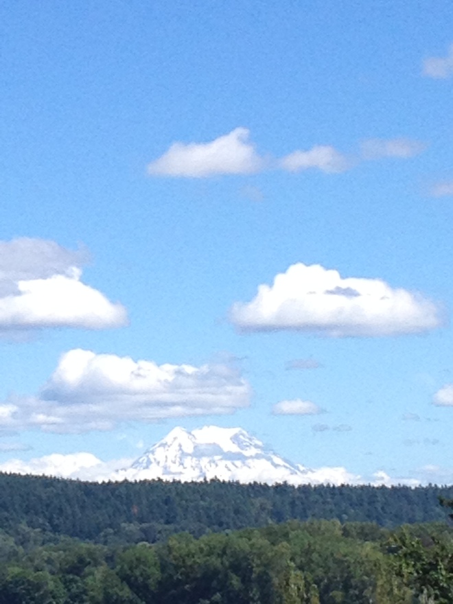
Heading east towards the Puget Sound with the sun was still making its appearance, we decided to skip the ferry ride and take the small road trip home. We headed south towards the Tacoma Narrows bridge with Mount Rainier dominating the landscape to the east. Our journey ended as we arrived home just as the sun made its final appearance for the day.
Motivational Monday 01/26/2015
Mount Baker Snowshoeing / Nooksack Falls
Since moving to the Pacific Northwest I have been interested to try snowshoeing. Growing up in Texas I was never really exposed to any snow activities. I assumed snowshoeing would be just like hiking in the snow; therefore, if I love hiking then I will love snowshoeing. With an REI gift card burning a hole in our pockets, my husband and I decided we were going to rent snowshoes and head to the mountains. We loaded up the car mid-afternoon and after a quick trip to REI we headed north towards Mount Baker. Our evening was spent in a charming cabin in Deming, WA. The only heat source for the entire cabin was a wood burning stove that warmed us as we spent the evening reading by the fireside. We woke up the next morning chilled as the fire from the previous night had died out hours before. We were filled with energy as we packed up for the less than an hours drive to the Mount Baker backcountry ski area. Within an hours drive we went from a green, lush environment to a winter wonderland in the North Cascades.

Mount Baker near Artist Point
We were geared up and hitting the trail by 10:00 am. Right away snowshoeing was a lot easier than I thought it would be. After reading trips reports from recent visits to the area I learned that when travelling up the trail we needed to stay to the right of the roped-off downhill ski area. Following this guideline we spent the morning and afternoon snowshoeing around the snow filled valley watching the skiers and snowboarders fly down the mountain zig-zagging through the fresh snow. Several feet of light and fluffy surrounded the area for miles in every direction. At times we would follow tracks created by other people and sometimes we would choose destinations and create our own pathways through the snow. As beginner snowshoers we decided not to attempt the hike to Artist Point and instead we spent the day familiarizing ourselves with the equipment snowshoeing around the valley.

Snowy treetops on Mount Baker
Exhausted from our days efforts hiking through the snow, we headed to the parking lot to load up and picnic in the car before heading down the mountain. As we left the snowy mountaintops behind, a sign for Nooksack Falls lured us off the highway for a short side trip. We made the quick trip the the waterfall viewing point, but the perspective from the fenced area near the top of the falls gives you just a peak of Nooksack Falls. I enjoyed the landscape looking downstream as a light fog hung over the valley in the distance.
The cold air urged us to head back to the warmth of our car and we continued our way back towards Seattle. As we drove away from Mount Baker and the North Cascades all I could think about was when I’d be back again. Soon I hope.
Wildlife Wednesday 01/21/2015
During a trip to the San Juan Islands with my family in 2012 we visited the Krystal Acres Alpaca Farm near Roche Harbor. The family running the business was very friendly and informative about all things alpaca. After touring around the farm and visiting the alpacas we shopped for items made with the very soft alpaca fur.


